

Maps of Current Interest Country Maps
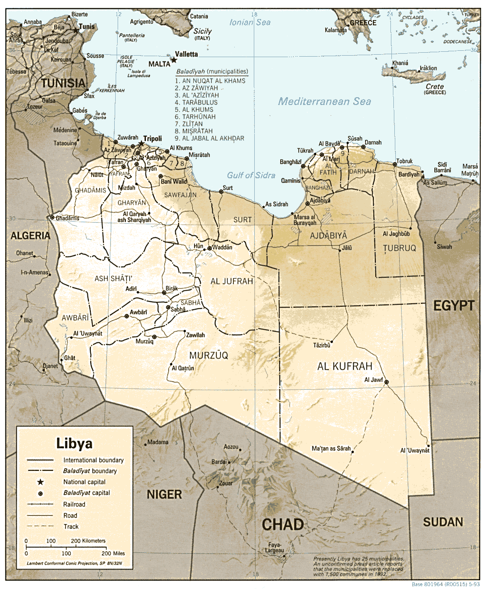
- (Libya (Political) 1993 (193K) and pdf format (203K
- (Libya (Shaded Relief) 1993 (250K) and pdf format (263K
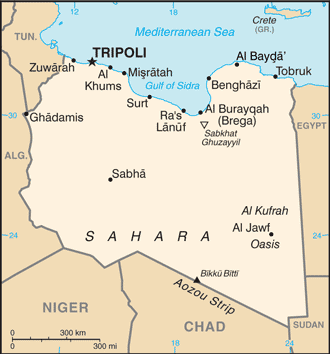
- (Libya (Small Map) 2013 (20K
Topographic Maps
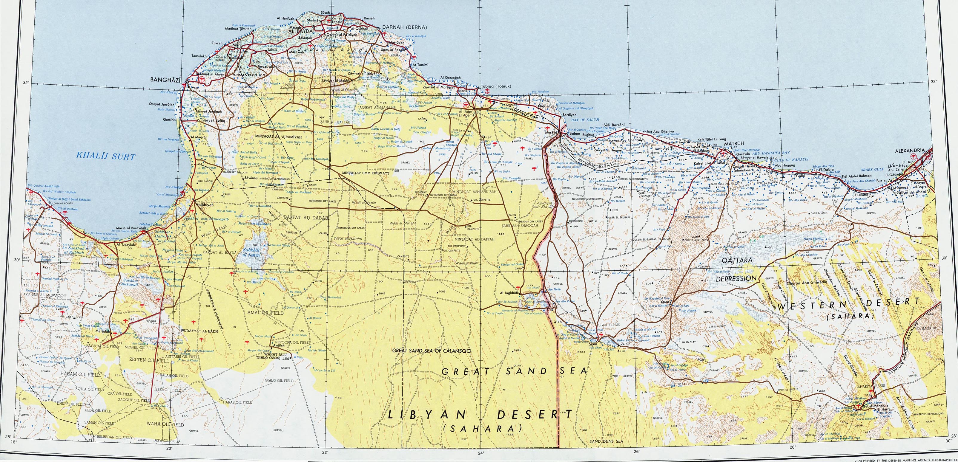
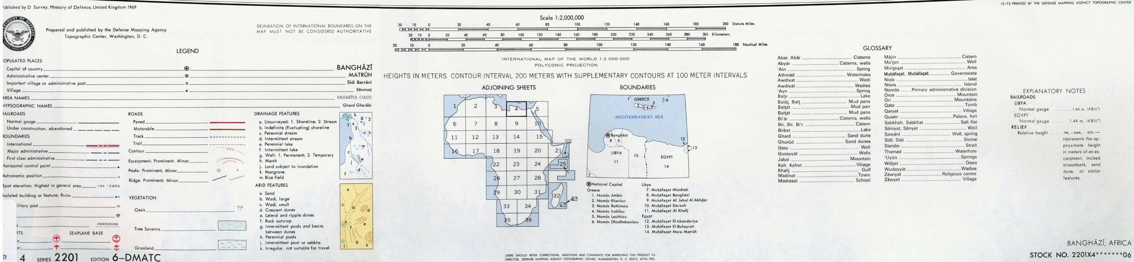
- 1:2,000,000 - Africa Topographic Maps (U.S. Army Topographic Command/U.S. Defense Mapping Agency)This series covers all of Libya1:2,000,000 - Northeast Libya 1969 (1.12MB) and map key and scale (401K)Portion of AMS Series 2201, Sheet 4 "Banghazi" original scale 1:2,000,000. Published by the U.S. Army Map Service, 19731:1,000,000 - International Map of the World (U.S. Army Map Service)Clickable map. This series covers most of northern and central Libya1:1,000,000 - Operational Navigation Chart Series U.S. Defense Mapping Agency Aerospace Center. Not for navigational useThis series covers all of Libya1:500,000 - Tactical Pilotage Charts U.S. National Imagery and Mapping Agency. Not for navigational useThis series covers Libya1:250,000 - North Africa Topographic Maps (U.S. Army Map Service) 1954-This series covers much of Northern Libya and some other parts of the country1:250,000 - Libya Joint Operations Graphic Aeronautical charts. U.S. National Imagery and Mapping Agency. Not for navigational useThis series covers most of Libya1:100,000 - Cyrenaica (U.S. Army Map Service) 1940-This series covers the eastern coastal area1:100,000 - Tripoli (U.S. Army Map Service) 1936-
- This series covers the western coastal area and Tunisia border
Historical Maps
- Banghazi North 1:5,000, Edition 3-AMS, Series P961. U.S. Army Map Service, 1962 (4.3MB)
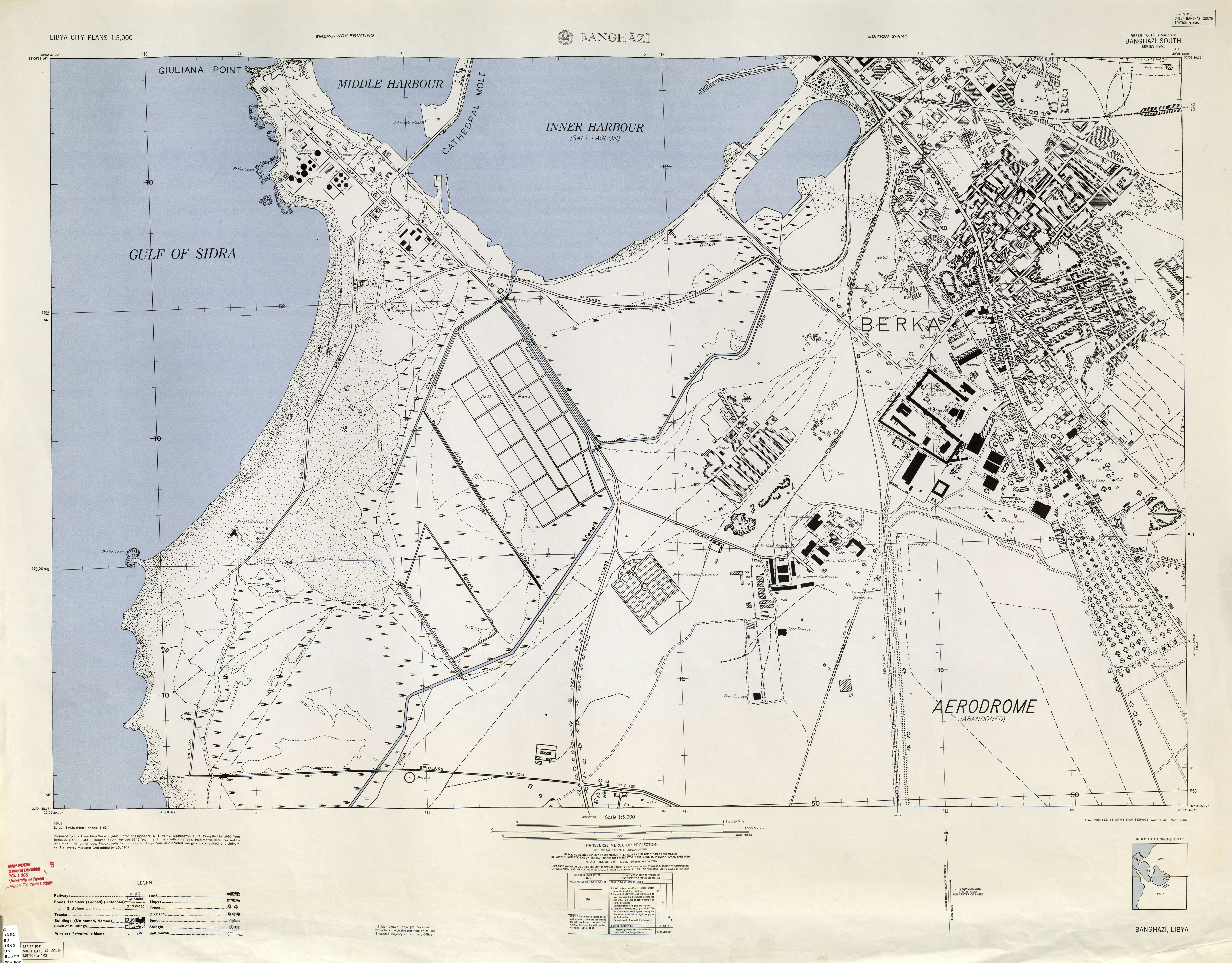
- Banghazi South 1:5,000, Edition 3-AMS, Series P961. U.S. Army Map Service, 1962 (5MB
- Tripolitania (Libya) City Plans U.S. Army Map Service, 1943
Thematic Maps
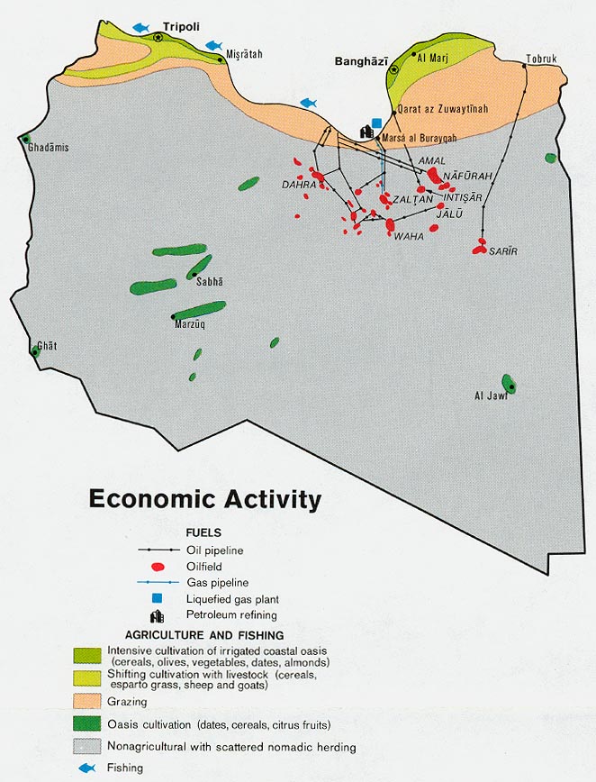
- (Libya - Economic Activity from Map No. 501564 1974 (140K
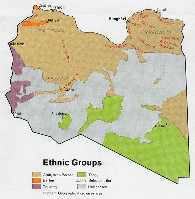
- (Libya - Ethnic Groups from Map No. 501564 1974 (130K
- (0Libya - Population from Map No. 501564 1974 (106K

ليست هناك تعليقات:
إرسال تعليق